The Old Road Beneath the New Route
Trace an old road beneath a newer route by comparing dated maps, surviving boundaries, and place names to separate documented alignments from informed guesses.
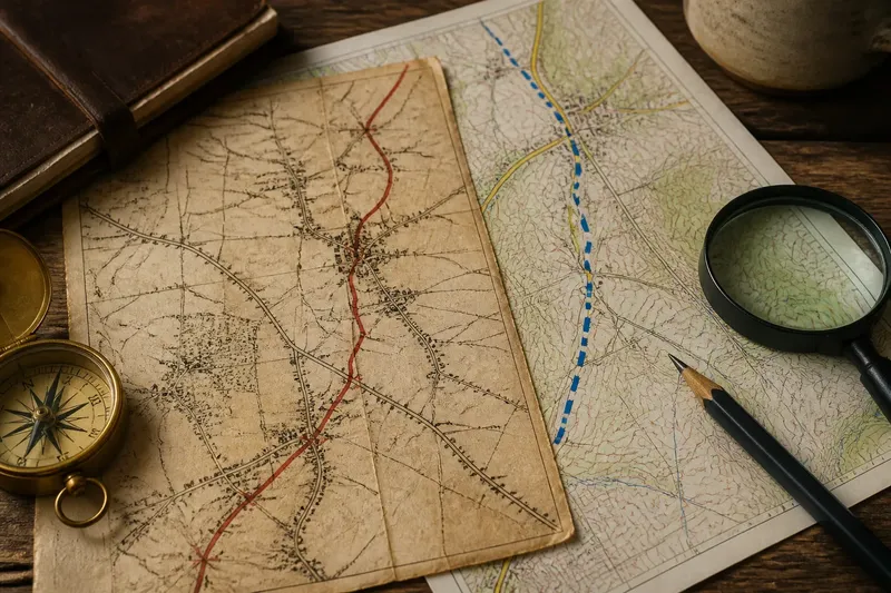
Where did the old road go when the current route took a different course? To trace an old road beneath a new route, compare dated maps with surviving boundaries, junctions, and place names, while keeping documented segments distinct from inferred ones.
A road may have been redirected around a settlement, absorbed into a newer road, or reduced to a field boundary. The task is not simply to find a line that looks plausible, but to work out which clues support a former route and where the evidence stops.
Compare dated maps
Begin with maps that cover the same area and identify their dates, scales, and legends. A current topographic map shows the present network; older map sheets or historical map scans may show a route that is now missing, differently named, or connected to a different junction.
Follow each suspected alignment through recognizable points such as a church, bridge, settlement edge, or road junction. A change in one label does not establish a change in the road itself, and two nearby lines may represent separate routes rather than the same road at different dates.
Scale affects what a map can show. A regional map may omit lanes and simplify bends, while a detailed local sheet may show tracks that never appear on the broader map. Read each legend before treating a dashed line as a road or an absent line as evidence that no route existed.
Record the map date, scale, route label, and the points where the alignment changes. This makes it easier to distinguish a mapped fact from your interpretation.
Trace surviving boundaries
When a road disappears from maps, its former corridor may persist in features such as a straight field edge, a narrow strip of open ground, or a line of trees. These traces matter most when they form a continuous alignment that connects mapped route segments or known junctions.
Compare aerial imagery with the map, but do not assume every straight boundary marks a road. A boundary may reflect later land division or drainage work. Note where the feature begins and ends, whether it lines up with other evidence, and whether a plausible alternative explanation remains.
Say you are comparing two invented map layers: an older sheet shows a lane ending near a farm, while a current map shows a road beginning beyond it. You then notice a continuous hedge gap on aerial imagery that links those ends and reaches the same junction. The resulting trace is a plausible connection, not a documented road, so mark the gap as inferred and keep the mapped segments separate.
Use different line styles for confirmed map segments and possible continuations. A reader can then see exactly where the record gives way to interpretation.
Check names and landmarks
Place names associated with a ford, bridge, gate, or pass can suggest where people once crossed or traveled. Check the name on maps from different dates and compare its position with nearby settlements and route segments.
Names can remain after a feature changes, or move from a landmark to a nearby settlement. Treat a name as a lead rather than a location pin. Old milestones, lane names, and roadside remains can add context, especially when several align with a route already indicated by maps.
A single object or label rarely establishes an entire road’s course. Look for a sequence of clues, and keep track of which source supports each segment.
Which evidence fits?
Which maps should I compare?
Choose maps that cover the same ground and show their dates and scales. Pairing a detailed older sheet with a current topographic map can make it easier to compare minor lanes than relying on regional maps that simplify them.
Can a place name prove an old road’s course?
No; a name may survive after a road or crossing changes, and its label may shift to a nearby feature. Use it as a clue, then check whether dated maps and other landmarks support the same alignment.
What if the road vanishes between mapped sections?
Record the last clear point on each side and look for a continuous boundary, track, or named crossing between them. If the connection is uncertain, mark it as inferred rather than drawing it as a confirmed road.
How should I show uncertainty?
Use one style for segments shown on dated maps and another for possible connections based on indirect clues. Add a brief note naming the evidence and any plausible alternative for each uncertain stretch.
Keep a route record
A short evidence record helps keep a reconstruction reviewable. For each possible segment, note what you observed and what decision follows:
- Observation: the older map shows a lane and the current map omits it; if the dates and location match, mark the lane as historically mapped, but if they do not, leave its identity unresolved.
- Observation: the suspected lines meet at the same mapped bridge; if the bridge location and route direction agree, treat the connection as supported, but if they conflict, investigate a different crossing.
- Observation: a regional map omits a minor track; if a detailed sheet shows it, use the detailed map for that segment, but if no suitable sheet exists, record the gap as unknown.
- Observation: a field boundary continues between two mapped endpoints; if it aligns with both, draw a separate inferred segment, but if it stops or bends away, do not extend the road along it.
- Observation: a place name refers to a ford or pass; if dated maps place it on the proposed alignment, use it as supporting context, but if the name moves or sits elsewhere, do not use it to fix the route.
- Observation: several roadside features align with the proposed course; if the sequence also matches mapped segments, add them as corroborating clues, but if only one isolated feature fits, keep the course uncertain.
Old roads can change course in stages, with a newer route following one segment and diverging at another. For the old road beneath a new route, the clearest account shows which parts are mapped, which are inferred, and what evidence would distinguish competing traces.
For questions about property boundaries, access, or heritage status, consult relevant official records and qualified local expertise rather than relying on a map-based reconstruction alone. A careful trace is useful not because it removes every doubt, but because it makes the evidence and the remaining choices visible.