Why a Direct Map Route May Not Be a Usable Shortcut
A direct map route can conceal steep slopes, wet ground, or missing crossings. Learn how to assess its terrain and continuity before choosing a path.
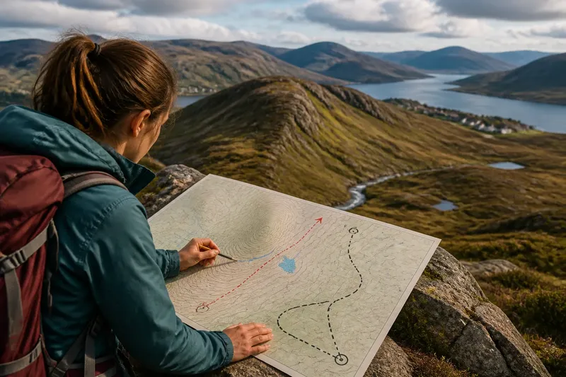
Can you trust a direct line on a map as a shortcut? Not until you know what lies between its endpoints. Across a northern landscape, a line may cross a ridge, a bog, or a stream without showing a continuous, passable route.
Imagine Mara planning a walk between two fictional settlements, Alder Inlet and Slate Haven. A dashed track curves around a ridge, while a direct line crosses its broad shoulder. She wants to know whether that line marks a usable shortcut, not merely whether it looks shorter on the page.
What Direct Means
A map shows land from above, so a straight line represents horizontal distance rather than the effort or time involved in walking. It leaves out the effect of slope, soft ground, vegetation, and obstacles. A direct route may therefore be shorter on paper but harder to follow or cross.
Contour lines help reveal the shape of the ground. Closely spaced contours indicate a steeper slope; wider spacing suggests gentler terrain. Contours do not show every surface condition, but they can warn Mara that her line crosses a ridge rather than an easy, level corridor.
She also checks the map scale and contour interval—the vertical difference between neighboring contour lines. These details help her judge whether the ridge is a modest rise or a more substantial barrier in the mapped terrain.
Terrain Along the Line
Mara traces the direct line across the contours. It crosses several bands on the ridge’s shoulder, while the dashed track bends along a spur, a strip of higher ground that projects from a ridge, before descending toward a stream valley. That shape makes the track plausible as a gentler approach, but it does not prove the surface is easy to walk.
She notices a wet-ground symbol near a shallow basin on the direct line. Low ground can drain poorly even where the map shows no large lake or river. A short stretch of saturated ground may be more difficult than a longer route on firmer terrain.
Blank or lightly marked space is not evidence of open, walkable land. It may simply mean the map provides little detail there. Treat missing surface information as uncertainty, not as confirmation that a route is clear.
Route Connections
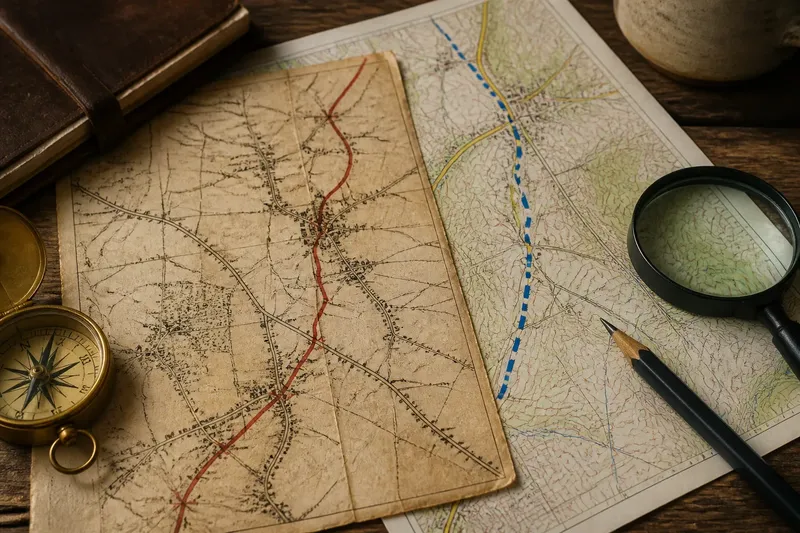
The dashed track changes appearance near a narrow stream crossing, then fades among the contours. Mara checks the legend to see whether the line represents a path, track, road, or another feature. Similar-looking strokes can have different meanings, and a mapped line does not necessarily indicate current maintenance or passability.
At the stream, she looks for a bridge, ford, or other mapped crossing. A path symbol that reaches the bank without showing how to cross may leave a gap in the usable route. She follows the line from start to finish, paying particular attention to changes in symbols, junctions, water, and steep ground.
A route can look connected as a drawing yet lack a clear passage on the ground. Check every point where the mapped line meets an obstacle.
Information the Map Omits
Maps simplify the landscape so readers can recognize selected features at a useful scale. They may omit small obstacles, temporary conditions, or changes in vegetation. A track mapped for vehicle access, for instance, is not automatically a suitable walking route.
The map cannot tell Mara whether wind makes the ridge exposed, whether recent rain has left the basin waterlogged, or whether the stream is easy to cross. If access or current conditions matter, she checks a suitable, up-to-date map and relevant local guidance. The legend and publication notes clarify what the map’s symbols represent, but they cannot answer every question about present conditions.
How to Judge a Direct Route?
Does the shortest map line mean the shortest walk?
No. The line represents horizontal distance, not slope or ground conditions. A route with fewer bends may require a steep climb or a difficult crossing that a longer path avoids.
What can contour lines tell me?
Contour spacing indicates how quickly the land rises or falls: close lines mean steeper ground, while wider gaps mean a gentler slope. The lines do not show the surface or establish that a trail exists.
How can I check route continuity?
Trace the route symbol from its start to its destination, checking changes in line style, junctions, water, and steep terrain. Consult the legend and look for a mapped crossing wherever the route meets water or another significant obstacle.
Is open map space safe to cross?
Not necessarily. Sparse detail means the map tells you less about that area, not that the ground is clear. Use surrounding contours and features to assess the likely terrain, and seek current information if access or conditions could affect the journey.
Comparing the Routes
For Mara, the starting information is the same fictional map, Alder Inlet and Slate Haven, the direct ridge line, the curved dashed track, a wet-ground mark, and a stream. She traces the direct line and notes its steep contour crossings and approach to the basin. She then follows the dashed track, observes that it bends along a spur, and finds a crossing symbol at the stream.
Her resulting decision is to plan around the mapped track, while treating the ridge line as an unverified alternative rather than an established shortcut. The tradeoff is a longer drawn route in exchange for a clearer mapped connection. She still checks current route information, because the symbols do not establish present ground or access conditions.
The comparison does not show that longer routes are always better. A direct path across gentle ground with clear connections may be sensible. The useful question is whether the line follows a plausible passage and connects its endpoints without relying on an unexplained gap.
Map Route Checks
Before treating a direct line as a shortcut, check each feature and let the result guide your next move:
- Observe whether the line crosses closely spaced contours; if it does, plan for steep ground or choose a gentler mapped route, but if contours are widely spaced, continue checking for other obstacles.
- Observe the contour interval and map scale; if either is unclear, avoid judging the slope from appearance alone and consult a more suitable map, but if both are clear, use them to interpret the terrain.
- Observe whether the line crosses wet-ground symbols or a low basin; if it does, seek current conditions or choose a route on firmer mapped ground, but if it does not, still check for other signs of difficult terrain.
- Observe whether the route symbol changes or disappears; if it does, check the legend and seek confirmation of the connection, but if it remains consistent, continue tracing it to the destination.
- Observe where the route meets water; if no bridge, ford, or other crossing is mapped, choose a route with a clearer crossing or seek reliable local guidance, but if a crossing is shown, verify that current information supports using it.
- Observe whether the map is current and appropriate for the route; if it is not, consult a suitable current source before relying on its access details, but if it is, remember that map symbols still cannot describe every present condition.
When a Line Is Direct
A useful route is a connected passage through the land, not just a line between two points. Ridges, basins, spurs, and valleys shape where movement may be plausible; map symbols record some connections, while omissions leave questions to resolve.
For a map route in northern terrain, compare its contours, likely ground conditions, and mapped crossings before treating it as a shortcut. A line that bends around a ridge may follow a natural corridor, while a straight-looking line may depend on a steep climb or an unconfirmed link.
Mara’s fictional walk illustrates how a reader can reach a cautious decision without claiming certainty about the ground. When a direct line depends on a crossing or passage the map does not establish, treat it as an unverified option and seek current information before relying on it.