Why Rivers Make Persistent Edges on a Map
Why rivers make persistent edges on a map: understand how river boundaries shape regional identity and what a mapped dividing line can—and cannot—tell you.
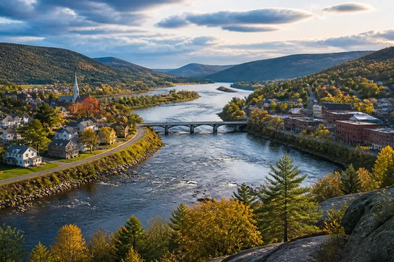
Why rivers make persistent edges on a map is easiest to see where a river separates two named districts: the water gives the division a recognizable course. A boundary description may use that river as a reference, but the channel’s visibility does not explain how people on either side relate to it or how the division came to matter.
Rivers as regional markers
A named river can give a boundary a shared point of reference. People may use its name when describing where one district ends and another begins, even if they rarely need to specify the exact dividing line.
That role can outlast changes in nearby settlement. A town may expand toward the river, or fields on opposite banks may acquire different place names, while the waterway remains the familiar geographic marker in local descriptions.
For a place name, the river can matter as much as the boundary: a district may be described as lying “north of the Graywater,” for instance. Such wording helps orient a reader, but it does not establish that the river is the district’s official edge.
Different kinds of division
A river can divide jurisdictions, but it can also connect communities. A ferry, bridge, fishing grounds, or shared riverbank may bring people on both sides into regular contact. The same waterway can therefore be a marker of difference and part of a common local landscape.
These relationships are not contradictory. A boundary is a way of organizing territory; it does not describe every social, economic, or cultural connection that crosses it.
Consider a settlement with houses on both banks and a market near the bridge. Residents might use the river to distinguish two neighborhoods while visiting the same shops and meeting places. The name of the boundary tells only part of the story of the settlement.
What does a river boundary mean?
Does the boundary follow the bank?
Not necessarily. A place name or broad regional description may use the river as a convenient marker without specifying a bank, channel center, or legal line. For a property or jurisdiction question, consult the relevant official record or a qualified surveyor.
Why do place names use rivers?
A river is a recognizable feature that can help people describe where a place lies. A name such as “Eastbank” may preserve that relationship even as roads, neighborhoods, or local boundaries change.
Can people share a river that divides them?
Yes. A river may mark a jurisdictional edge while supporting shared access, travel, fishing, or community events. The boundary and the everyday use of the river describe different relationships to the same place.
What if a river changes course?
A changed channel can alter how the landscape looks, but it does not by itself settle whether a place name or official boundary has changed. That depends on the wording and context in which the name or boundary is used.
Reading local language
When a river appears in a district name or local description, ask what the wording is doing. It may identify a region, point to a familiar landmark, or specify an official boundary; those uses should not be treated as interchangeable.
For instance, “across the Alder River” can describe a direction from the speaker’s location, not a permanent division between two administrative areas. In conversation, the phrase may be perfectly clear even when it would be too broad for a formal boundary record.
Local names can also persist after their original reference becomes less obvious. A neighborhood might retain a river-based name after bridges and newer streets become more prominent. The name records a relationship to place, not necessarily the current shape of a boundary.
When the river changes
Channels can shift, divide around islands, or become less prominent as people build along their banks. These physical changes may affect local descriptions, but names and boundaries do not necessarily change in step with the water.
Imagine a fictional district called Northbank, named for its position beside the Alder River. A new channel forms after a flood, leaving the old course quieter and the new flow closer to a row of houses. Residents could still use Northbank as the district’s name, while an official boundary question would require checking the applicable record rather than inferring a change from the new channel alone.
For ordinary orientation, a river name is a useful clue. For legal or property matters, rely on the governing document and seek qualified local advice when needed.
Questions about river boundaries?
Does a river name define a district?
Not by itself. A river name may help identify a place, while the district’s formal limits are defined separately.
Can a boundary cross a river?
Yes. A boundary can cross a river or leave it at a particular point. The name of the river does not determine the boundary’s full course.
Do bridges change the meaning of a river boundary?
A bridge can connect places on opposite banks, but it does not by itself change their names or jurisdictional limits. It changes how people move across the river, not necessarily how territory is defined.
Useful distinctions
When someone describes a river as an edge, identify whether they mean a local landmark, a place-name reference, or an official boundary. The distinction helps prevent a familiar geographic description from being mistaken for a precise statement about authority or ownership.
- If a place name includes a river reference, check whether it names a neighborhood or an administrative area; if it names only a neighborhood, treat it as a local identifier rather than proof of an official limit.
- If a description says “across the river,” identify the speaker’s point of reference; if that point is not clear, ask which bank or place they mean instead of assuming a fixed boundary.
- If residents use the same river facilities from both banks, distinguish shared use from jurisdiction; if the question concerns access rights, check the relevant local rules.
- If an old river-based name remains in use, compare it with current place names; if the older name is informal, use current official names for formal correspondence.
- If a changed channel raises a property or district question, consult the controlling record; if its meaning remains uncertain, seek a qualified local professional rather than relying on the visible watercourse alone.
- If a river is described as the boundary, check whether the wording names a bank, channel, or another reference; if it does not, treat the description as broad orientation until an authoritative source clarifies it.
Why rivers make persistent edges on a map is not just a question of the line’s shape: rivers also give regions a memorable shared reference. That reference can help explain local names and everyday descriptions, while the distinction between a familiar marker and an official boundary keeps those descriptions in their proper scope.